Case study · Emergency coordination, mobile
Livestock Coordination Network
From wildfire chaos to a live iOS app that matches livestock owners, haulers, and safe spaces under pressure.
- Industry
- Emergency coordination, mobile
- Engagement
- Pro-bono mobile build
- Status
- Live on the App Store
The challenge
During the August 2026 Bradley Creek and Bald Range wildfires, trailers showed up, but nobody shared one picture of who needed help, where, how many animals, what trailer type, or where animals could go.
Coordination lived in Facebook, texts, and phone calls while people loaded animals in smoke. Roadblocks needed exact addresses and headcounts. Duplicate trucks hit one property while another nearby went unmatched.
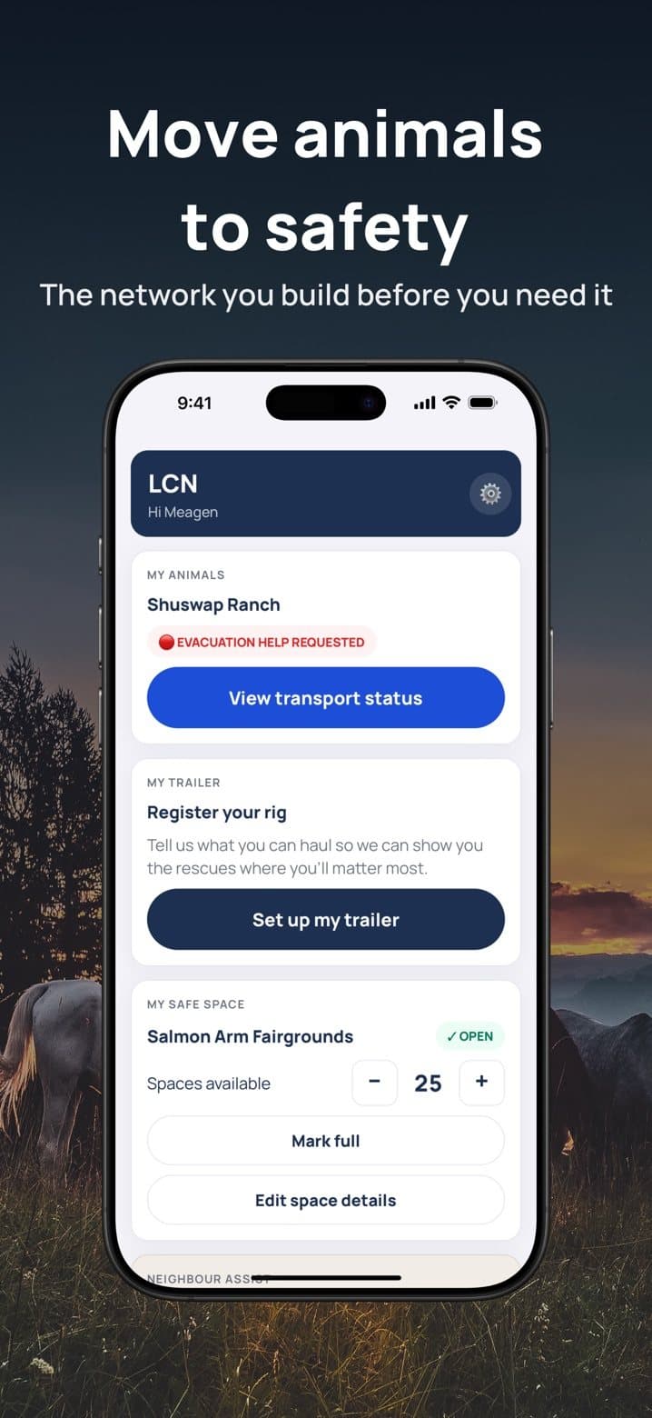
Founder Meagan Bucar wanted one simple place, usable one-handed, outside, with thin cell service, for owners, haulers, hosts, and coordinators.
What we built
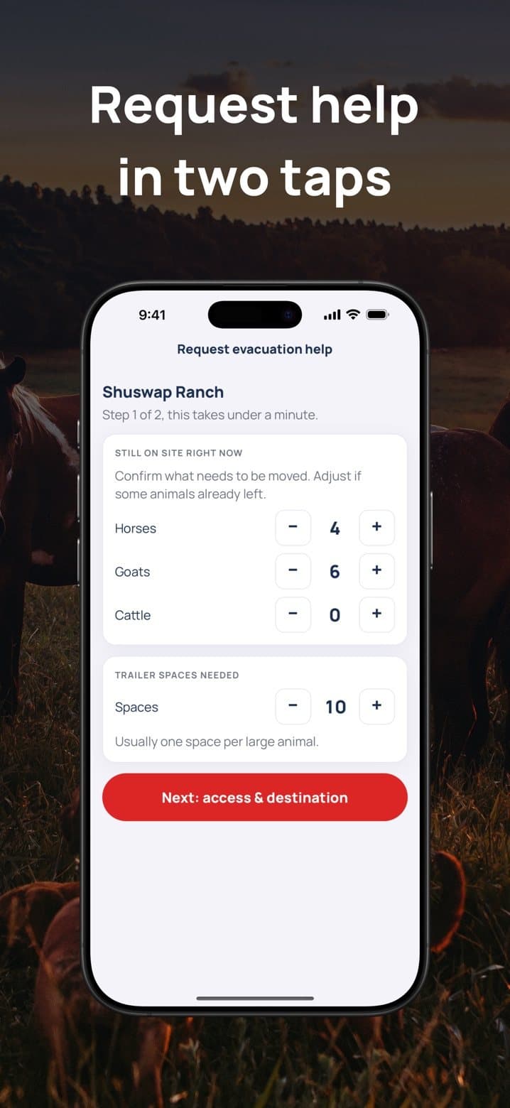
- SOS requests in two taps, with animal counts and trailer space
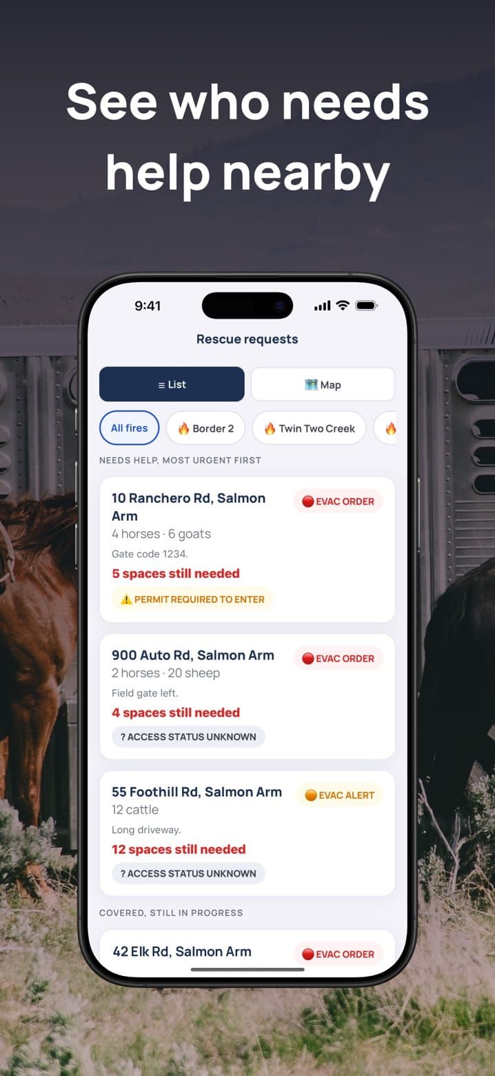
- Nearby matching so haulers see who needs help closest to them
- A live map with BC wildfire and evacuation overlays from open data
- Access and permit cues before a hauler heads in
- Neighbour-assist profiles for people who can't ask for help themselves
- Offline SOS by SMS keyword when data is down
Results
- Live on the App Store as LCN: Livestock Coordination, free
- Concept to working prototype in days, by August 12, 2026
- Covered in the press, including Kelowna Capital News and Real Estate Magazine
“I think I started to cry. I couldn't believe it. I was actually expecting to pay for it.”
Meagan Bucar
Founder, Livestock Coordination Network (via Kelowna Capital News)
Find out where AI pays off. Then build it.
Tell us where you are and we'll map the path together.